Soft Sediment Deformation, Upper Columbia River


The northern reach of the Columbia River, or "Upper Columbia", runs for 100km from Kettle Falls to the Hellgate bend. This is granite country, just beyond the feather edge of the basalts. Pleistocene Glacial Lake Columbia formed behind the ice dam created by the Okanogan Lobe during its southernmost advance. The lake accumulated an enormous amount of silty bottom sediments (Pardee's "Nespelem Silts") and a considerable amount of non-lacustrine sediment. The lake's level fluctuated considerably during its life (up to 730m elevation), rising and falling several times in response to outburst floods entering from the east and possibly the north. The lake sediments are today exposed in vertical shoreline bluffs along Lake Roosevelt, the portion of the Columbia River impounded behind Grand Coulee Dam. In the bluffs lies a geologic record of a dynamic landscape developing along the irregular southern margin of the Cordilleran Ice Sheet. It was a place where proglacial lakes formed and spilled, glaciers advanced and retreated, and extensive kame terrace systems grew as ice downwasted. At a smaller scale, the bluffs preserve a wide variety of soft sediment deformation structures, including clastic dikes.
Geologists who have worked the area are relatively few despite the valley's proximity to Spokane and its abundance of large outcrops accessible by foot, flatwater kayak, or ski boat. Publications by Joseph Pardee, F.O. Jones, Eugene Kiver and Dale Stradling, Carrara and Trimble, Michelle Hanson and John Clague are just about all you will find. Atwater's sites in the Sanpoil Valley are located some 40km southwest of here. There's a lot of unexplored country between here an there, despite what some would have you believe. Some guidebooks give the impression that the geology up here was sorted out in the 1980s. Let me assure you, it was not.
An excellent summary of the area's ice age geology is Chapter 17, written by Richard Waitt and others, in The Geology of Washington and Beyond: From Laurentia to Cascadia (Cheney, 2016, University of Washington Press).
An early field season tends to keep the academics away. Fieldwork along the lake must be completed during the low-reservoir period extending from March to May. Access to beaches is managed by two separate Indian tribes (Spokane, Colville) as well as some private housing developments (i.e., Deer Meadows at Seven Bays). But permits and permission are available. A good number of boat launches and nice campgrounds can support a Spring field campaign.
The Okanogan Highlands region in general, and the Upper Columbia River in particular, are places where important new discoveries can still be made. Seldom-visited outcrops are abundant. In a world where many Geologists have traded fieldwork for the comfortable workstation or some spotless chemistry lab, the Upper Columbia feels refreshingly old school. Its a place where boot leather field geology is still being done.
Drop me an email if you plan on visiting the area. I'll meet you at the coffee shop in Hunters.

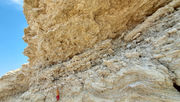
Thick, laterally-continuous zones of soft sediment deformation are common.

Shear fabrics in lacustrine muds resemble textures in high grade metamorphic rocks.

Large, unsheeted clastic dikes filled with sand, cobbles, and rip-up clasts intrude >10 meters through the section.


T-shaped mud squirts in the Sanpoil Valley. Glacial Lake Columbia lake-bottom muds deformed by overriding sand bed (density current from Missoula flood entering the lake). Sand is deformed along with the squirts. Glacial outwash terrace gravels lie unconformably above.

Injected sills with shattered fills at Indian-Hawk Creek.

Cool old map of mining districts in NE Washington. How did the old timers put it? "Mining saves lives". "Mining makes your day". "Mining: Better than a punch in the mouth". Something like that, anyway.


