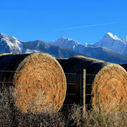
A Visit to Rich Chambers' Jocko Site - Western Montana
Last week I had the pleasure of a day in the field with Rich Chambers and Larry Smith. Rich did early work on Glacial Lake Missoula sediments at the now famous Ninemile Creek Section west of Missoula, MT (Alt and Chambers, 1970; Chambers, 1971, Chambers et al., 1984; Chambers and Curry, 1989; Chambers, 2016). His graduate work under David Alt built on a rather tidy stack of articles published up to that time - Alden, Pardee, Flint, Richmond - who offered big picture stuff, mo


Sill Injectites w/ Shattered Fills at Indian Creek, WA
At Indian Creek, WA I discovered 3 breccia-filled sills injected into varved Glacial Lake Columbia sediments, each extending for more than 10m across the exposure. The sills are one of several flavors of flood injectites found along the path of the Ice Age megafloods. Sedimentary sills extend for several meters across exposures along Indian Creek Road. Indian Creek is a tributary to the upper Columbia River north of Davenport, WA. They kind of have flat tops....hmmm. The enor


Dike-Sill-Dike Geometry in a Fluid-Driven, Sediment-filled Fracture
Coarse Grained Layers Behave as Efficient Pathways - Coarse grained layers appear to behave as efficient pathways during propagation of fluid-driven fractures that fill with sediment (clastic dikes). Under a vertical load (O1 is vertical), fluid pressure (Pf) opens a vertical dike against the minimum principal stress (O3 is horizontal), so Pf >> O3 at Time A. When the fracture encounters the coarse grained, low-resistance layer, further propagation becomes easier in the horiz


Scabland Evolution: Building on Perron & Venditti (2016)
In their 2016 Nature News & Views article titled "Megafloods downsized", Perron and Venditti remind us that the sizes of individual scabland megafloods remains uncertain. They question the assumption that every flood filled Scabland channels to the brim. I am sympathetic to their ideas. Fluvial systems incise over time and leave behind flights of terraces. Vestiges of terraces occur in the Channeled Scabland. Geomorphic rules hold even in megaflood landscapes. In places, sets


Paper Locations
Nearly 100 articles published over the past century mention clastic dikes in the megaflood region. Most did not focus on the dikes, but mention them in passing. The list includes journal articles, agency reports, field guides, theses, and conference abstracts. Fewer than 10 articles contain data. I've certainly forgotten a few. Remind me: skyecooley@gmail.com. ** Need to add: Kiver and Stradling's work in upper Columbia region #clasticdikes #megafloods #missoulafloods #inject


Two Generations of Clastic Dikes in Touchet Valley, WA
An excellent outcrop located along Touchet River Road North, some 13 miles north of Touchet, WA exposes two sets of clastic dikes. The older set contains silt, displays crisp vertical sheeting, and intrudes silt-pebble diamicts that are oxidized and contain abundant soil features consistent with their age (>35 ka). Dikes of the younger set contain coarse black sand, are crudely-sheeted or unsheeted, and intrude deformed slackwater rhythmites deposited by the Missoula floods (


Predicting liquefaction extent in the Yakima Fold Belt
Geologists have long debated how large of an earthquake Yakima Fold Belt faults can produce. Some claim these shallow (<10km), intraplate structures are capable of generating quakes up to 7.0 magnitude. Others estimate their capability no higher than about 6.0 magnitude. The difference between 6.0 and 7.0 is huge. I've personally experienced two Alaska quakes larger than 7.0 M. Believe me, crazy sh*t happens above magnitude 7. I've also been in several 6.0 M quakes. Those, by