Mollman Pass Trail Guide - Mission Mountains, MT
There are no trail guides to the east slope of the Mission Mountains. This post and future posts will attempt to remedy that. The "Mission Range" map from Cairn Cartographics is the best map for the area.
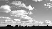
Mollman Pass Trailhead The trailhead is located SE of Ronan, MT. Three miles south of Ronan, Mollman Pass Trail Road intersects Hwy 93. Turn east off of Hwy 93 onto Mollman Pass Trail Road and follow it for 3 miles, passing the Kickinghorse Work Camp. Turn left onto Hammer Dam Road and follow for 0.5 miles. The prominent peak to the east is Mt. Calowahcan. At the sharp bend, continue straight over the cattle guard onto a dirt road and onto CSKT Tribal Land (permit required). Continue for 0.4 miles on the dirt road that winds though open ponderosas to the bridge over the canal. Sign #1 is on a tree ahead. Cross the canal and continue straight past the sign on a rough road for just over a mile to an obvious intersection and sign #2. Park here and begin hiking or turn right and drive for another few minutes to sign #3.

Sign #2. Mollman is a pass. Terrace and Swartz are lakes.

Sign #3 along the road to the trailhead.
The Hike The trail begins where the road ends, in cedar forest. It is well-graded, similar to the PCT and other trails designed for horse packing. Begin in dark cedar forest, work upwards into meadows of the lower basin, through cliff bands, and finally into upper lakes basin and the pass. Good footpath that increasingly grows rockier and steepens as you near the pass. There are a few lakes at the pass, which are pretty and hold fish. Its worth exploring the area of the pass and beyond. Trail has no route finding challenges. Moderately strenuous. Approximately 12-14 miles round trip, depending on where you park and how much hiking you do at the Pass.

The 2nd creek crossing is easy most of the year, here in late Summer.

The trail breaks out of forest into the meadows around 5500'.

Fall colors in the meadows peak in September. Watch for nettles along this stretch.


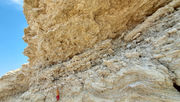
Trail winds through cliff bands as you approach Mollman Pass (~6500')


Waterfall in lower basin


This carved cross looks to be new. Reaching it means you've almost made it to the Pass - just 10 more minutes to go.

Entrance to the Mollman Pass lakes basin (6916'). The sign also marks the watershed divide. To the east is Forest Service land, to the west Tribal Wilderness managed by the Confederated Tribes of the Salish-Kootenai (CSKT), based in nearby Pablo, MT.

Two perfect - and surprisingly large - subalpine lakes occupy the upper basin. Get off the beaten path by circumnavigating them. A few established campsites can be found near the trail. Away from the trail there are no such sites. The area appears to receive very little use, except for the occasional pack trip.


Mollman Pass


Moving on.

Footprints of a small bear along the lake. We saw some grizzly scat along the trail lower down, too.

Cool rocks at the Pass.

The trail ends in a boulder field on the east side of the lake basin, where you peek into North Fork Elk Creek drainage with the Swan Valley and Bob Marshall Wilderness beyond.


A prominent boulder field marks the eastern end of the Mollman Pass Trail on the USFS and Cairn Cartographics maps. Informal animal trails continue down into the North Fork Elk Creek drainage, possibly connecting to Trail #301 that leaves from FS Road #10291 located several miles west of Condon, MT.


Beyond the boulders the trail grows thin.
Our Hike in Late September 2018 9:25 am - Park truck at sign #2. Walk forest road leading to the right. 9:47 am - Reach sign #3, pointing to trailhead. 10:00 am - Reach sign #4 (actual trailhead). Begin ascent of gentle grade through old growth cedar forest. 10:30 am - Cross creek on logs and boulders below 3 small waterfalls (easy). Continue upward through switchbacks in cedar-larch-pine-fir forest. 10:45 am - Creek crossing on logs and boulders (easy). Continue along ever-ascending trail through forest. 11:15 am - Break out of cedar forest into lower basin meadows. Cliff bands and ridgelines above. A shallow lake is visible below. Waterfall across valley. Colorful fireweed, slide maple, and willow in Fall. 11:40 am - Carved cross in tree stump. 12 noon - Reach Mollman Pass and USFS Wilderness Boundary sign. Lunch and exploration of lakes basin. 1:45 pm - Leave Mollman Pass lakes basin. 3:30 pm - Arrive back at truck. Car-to-car = 6 hours. We hike fairly fast.
Tribal Permits
Buy a tribal permit from the CSKT Fish & Wildlife office in downtown Polson, MT (406 6th Street, 406-675-2700). We paid $17 each in 2018. The Ronan Sports & Western store used to sell them, but it closed in Sept 2018. Westland Seed sells them now.