Ptarmigan Peak

I had an enjoyable mountain ramble up Ptarmigan Peak starting from Rabbit Lakes Trailhead. Hiked ~2 miles up Rabbit Lakes Trail, then moved off to the left, making a long rising traverse over tundra towards the snowy saddle at the base of Ptarmigan's west ridge. Kicked steps up easy snow and gained west ridge. From here its a big drop down to South Fork Campbell Creek. Followed blocky terrain and a few short snow crossings to gain rounded western summit, mainly sticking to the right side of ridge. Eastern summit prominent a few hundred yards distant. Continued over easy ground along summit ridge and to the right around the base of walls and gendarmes to gain eastern summit, where the register is stashed. Spent 10 minutes on top. Descended broken ramps and loose gullies to gain long snow finger spilling to within a 1/4 mile of Rabbit Creek Trail. Class II-III. Left the trailhead just before noon, back to the car around 3:30pm. Saw no one else on the route.


South Fork Campbell Creek valley (Powerline Trail).


East summit of Ptarmigan as viewed from west summit. The route swings to the right around the base of the steep walls, then hooks left around the back, up short rock steps to the top.

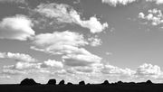
McHuge ridge in distance.


Rounded western summit with Anchorage and Cook Inlet beyond.

Eastern summit of Ptarmigan and summit register. I always sign in the same way: "100mph winds shredded the tents. We had to eat the camels. The girls loved it." - Sven Hedin


Back at the house, first-of-the-season thunder heads beginning to build over the Kenai.